
Shop by Collection
-
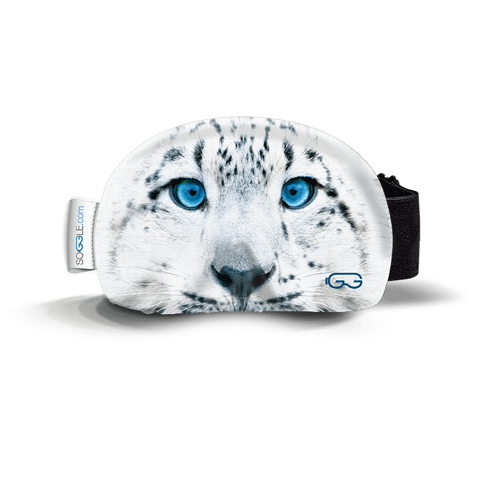
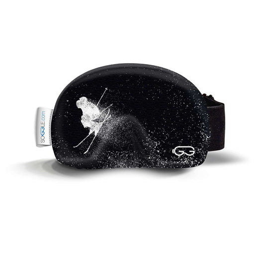
SOGGLE Protection
Small and perfectly formed, our goggle protectors by SOGGLE are the stylish...
-
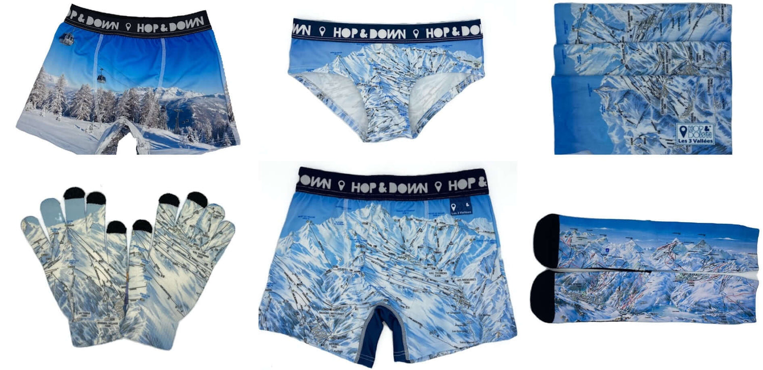
HOP&DOWN Piste Map Clothing
HOP&DOWN are a French brand, exclusively available in the UK on wipeoutstore.com...
-
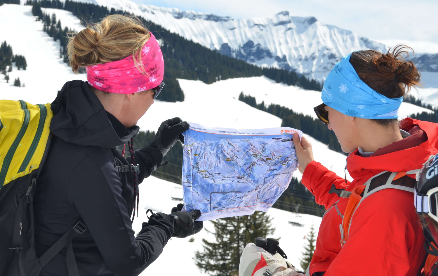
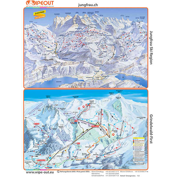
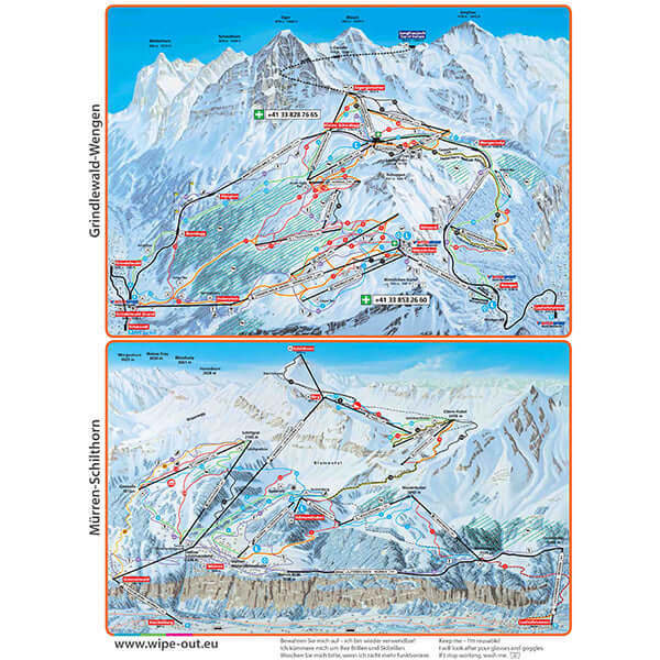
WIPEOUT Piste Maps
Once you've tried it, you won't look back - a great alternative...
-
LEGO®, Gifts & Games
Useful & Fun - for Everyone We specialise in gifts for mountain lovers, scroll...


Our Best Sellers For You
-
Goggle Protectors by SOGGLE
Regular price £12.99 GBPRegular priceUnit price per -
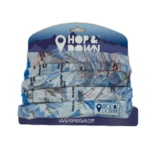
Piste Map Lightweight Snoods from HOP&DOWN
Regular price £13.90 GBPRegular priceUnit price per£16.90 GBPSale price £13.90 GBPSale -
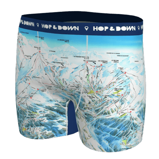
Piste Map Boxer Shorts - MEN & WOMEN
Regular price From £24.50 GBPRegular priceUnit price per£35.00 GBPSale price From £24.50 GBPSale -
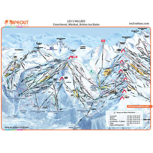
Three Valleys - Microfibre Piste Map by WIPEOUT
Regular price £14.99 GBPRegular priceUnit price per
More Gifts that are Useful & Fun - for Everyone
-
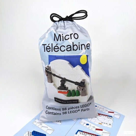
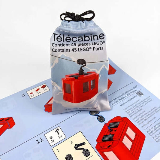
Mini Telecabine made from LEGO®
Regular price £23.99 GBPRegular priceUnit price per -
Red Telecabine made from LEGO®
Regular price £17.99 GBPRegular priceUnit price per -
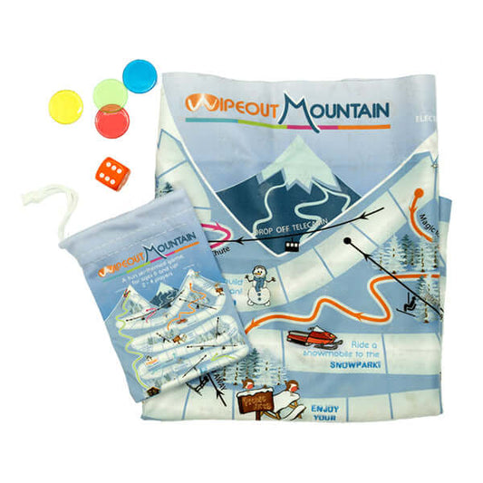
Wipeout Mountain 'Snakes & Ladders' Travel Game
Regular price £6.99 GBPRegular priceUnit price per -
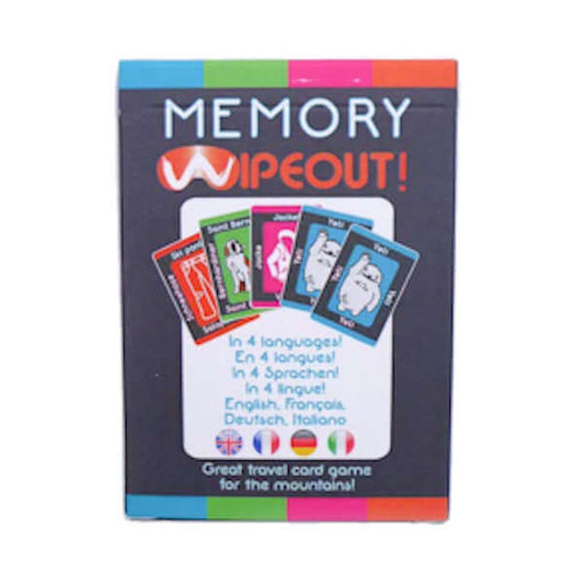
Wipeout 'Snap & Memory' Travel Game
Regular price £6.99 GBPRegular priceUnit price per
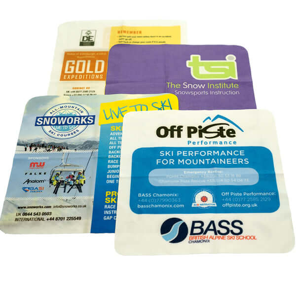
BUSINESS CARDS ON CLOTH
The key to a great business card is to give something that people will keep - which is why these microfibre fabric business cards are so effective. They double as a lens cloth so live in pockets, goggle bags, rucksacks and glasses cases for years. Get a quote.